Clare Maps and distances to help orientate you
Any of Clare’s wonderful highlights can be easily reached within a morning or afternoon.
County Clare is less than 130 km (80 miles) from end to end. When staying within the County, any place, attraction, or activity can be easily reached within a morning or an afternoon. Below is a simple map, some sample distances, and a link to a map that will show you what’s nearby to wherever you are in Clare or wherever you plan to visit.
A simple overview map of Clare
This map features some of the main towns and villages, to help orientate you
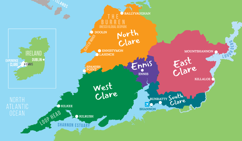
Above is a simple overview map of County Clare, highlighting the different broad areas, to help orientate you. These broad areas are also useful to know when filtering any search results by area.
Travel distances within Clare
This can help you plan your days
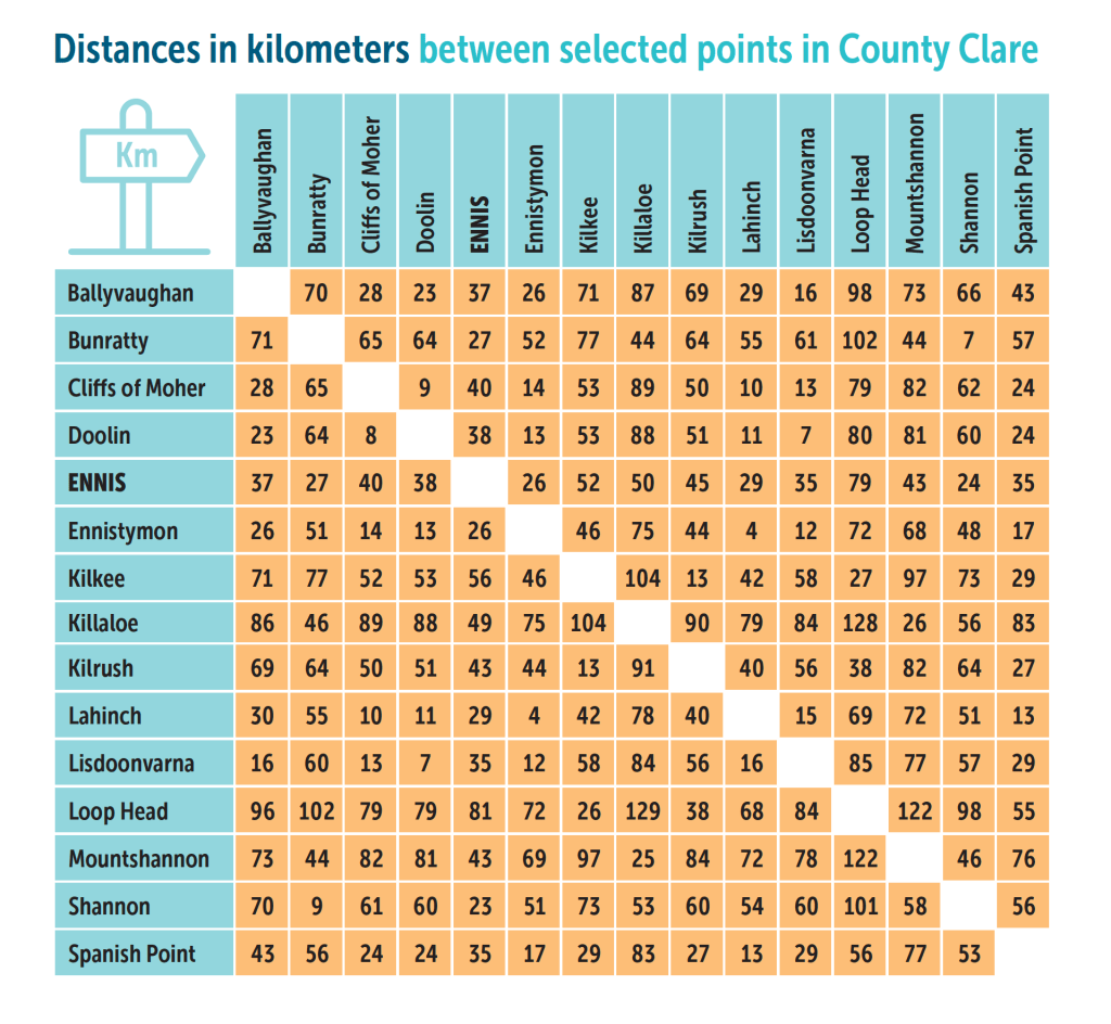
This distance matrix can help you plan your itinerary during you time in Clare. Distances are approximate and are based on the most direct routes, by car.
Travel times within County Clare
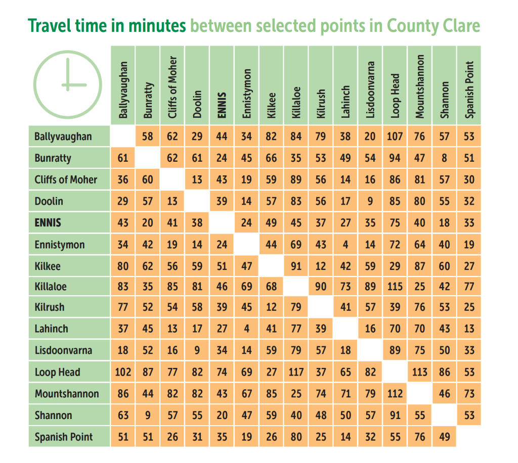
This travel time matrix can also help you plan your days in Clare. Times are approximate (in minutes) by car and are are based on the most direct routes. It’s important to note that times are for planning purposes only. They will also vary based on weather, traffic conditions, road works etc.
See our ‘Show near to’ map
Here’s a great tip!
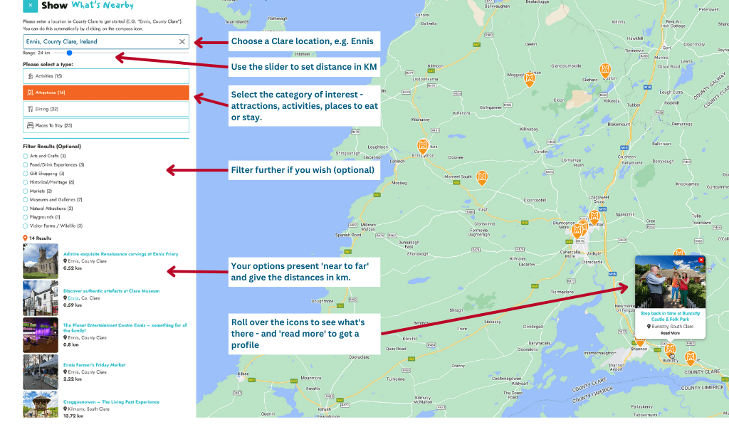
Our ‘show near to’ google map is really handy. Pick any place in Clare and you can see what’s near to it. You can also use the distance ‘slider’ to set any distance parameter (the default is 50km) and then filter by attractions, activities, places to eat, or places to stay. For example, places to eat within 10km of Ennis (the county capital); or places to golf within 60 km of wherever you are staying in Clare. You can view the ‘Show Near to” map here.