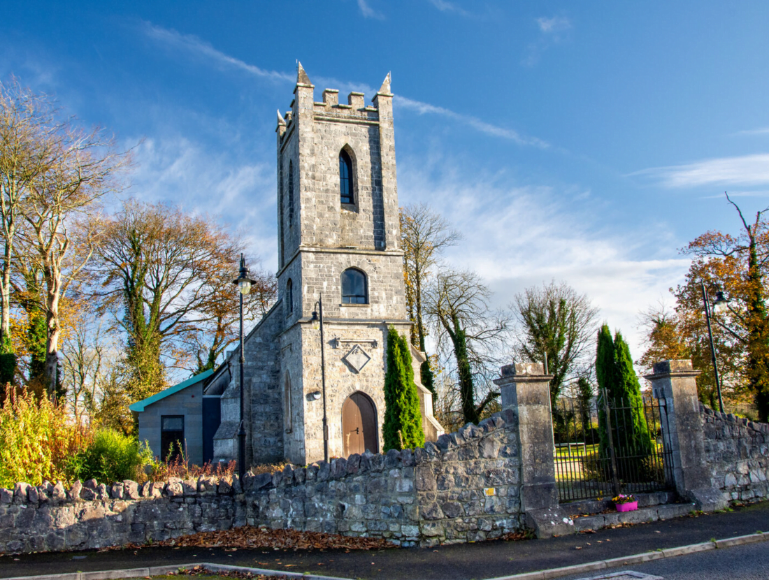
Experience the 12 O’Clock Hills Walks
Kilkishen, East Clare
This is a hill walking facility with 3 different route options as follows:
A 5 km heritage walk which is mostly flat except for an incline along the Crag river. This linear walk takes in Heritage sites and a Mental Health trail leading to a Fairyland facility for families.
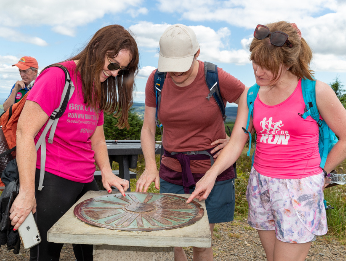
An 8.5 km fairly strenuous looped walk up and over the 12 O’Clock Hills at 309 m elevation. The upper 12 O’Clock Hill has a compass/sundial to remind people of how people measured time before clocks were invented.
A 13 km strenuous looped walk for people with a bit more time to spare. This looped walk takes in an additional hill named Loughavarra at 252m + the 12 O’Clock Hills at 309m.
All 3 hiking options have recreational furniture for rest periods. The upper hills have panoramic views across the Munster region and have display maps identifying the distant views possible from these points.
Take in the 360° views of the 12 O’Clock Hills
Instructions: Click and drag to explore the 12 O’Clock Hills from every angle. For the best effect, switch to full screen using the icon at the top right of the image.
Good to Know
Trailhead: Belvoir, Kilkishen, East Clare
Visitor Facilities: Public toilet facilities available
Services: Kilkishen Village, East Clare
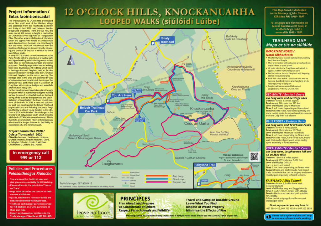
Route Information
This facility has 3 looped walking trails, namely Red, Blue and Purple. They are marked with coloured arrowheads on waymarkers or steel plates. All trails take in the Crag River walk, which is approx. 0.6km from the car park. Red includes a Spur to Fairyland and Stepping Stones recreational area. Blue trail takes in the 12 O’Clock hills and via Sunyata Buddhist Centre and Fairyland on its return journey to the car park. Purple trail has an added hill named Loughavarra + the 12 O’Clock hills.
RED ROUTE / Bealach Dearg…via Crag river and heritage sites
Distance: 4 km or 3.5 miles approx.
Total ascent: 160 meters or 525 feet
Level of difficulty: Easy to Moderate
Time: 1 to 2 hours, depending on fitness level
Terrain: Coillte roads, hard-cored pathways and some muddy spots during wet weather, especially on the Crag River trail section
BLUE ROUTE / Bealach Gorm… via Crag river and 12 O’Clock Peaks
Distance: 8 km or 5 miles approx.
Total ascent: 304 meters or 997 feet
Level of difficulty: Moderate to Difficult
Time: 2 to 3 hours, depending on fitness level
Terrain: Coillte roads, hard-cored trails, a boardwalk that can be slippery and some muddy spots, especially in forest sections.
PURPLE ROUTE / Bealach Corcra… via Crag river, Loughavarra hill and 12 O’Clock Hills
Distance: 13 km or 8 miles approx.
Total ascent: 499 meters or 1,637 feet
Level of difficulty: Difficult (carry a snacks or lunch and water)
Time: 3 to 4 hours, depending on fitness level
Terrain: Public and Coillte roads, hard-cored trails, a boardwalk that can be slippery and some muddy spots, especially in forest sections.
FAIRYLAND / Sióg Talamh
Distance: 4 km or 2.5 miles linear walk (return included )
Level of difficulty: easy and buggy friendly
Time: 1 to 2hrs return, longer with a buggy
Terrain: Hard-cored road and path suitable for a buggy.
Follow the fairy signage from the car park to get there
Minimum Gear: Sturdy walking boots, rain gear, rucksack, fluids, snacks/lunch, mobile phone.
Download a one-page PDF map
You can download a one-page, 4.8mb PDF map of the 12 O’Clock Hills walks here.
About Kilkishen