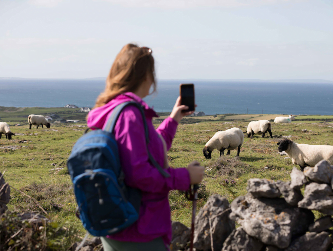
The Black Head Loop Walk is a challenging 26 km walk – a mix of Burren hill and coast, following green laneways, tracks, and mountain paths with some wonderful views of Galway Bay and the Aran Islands.
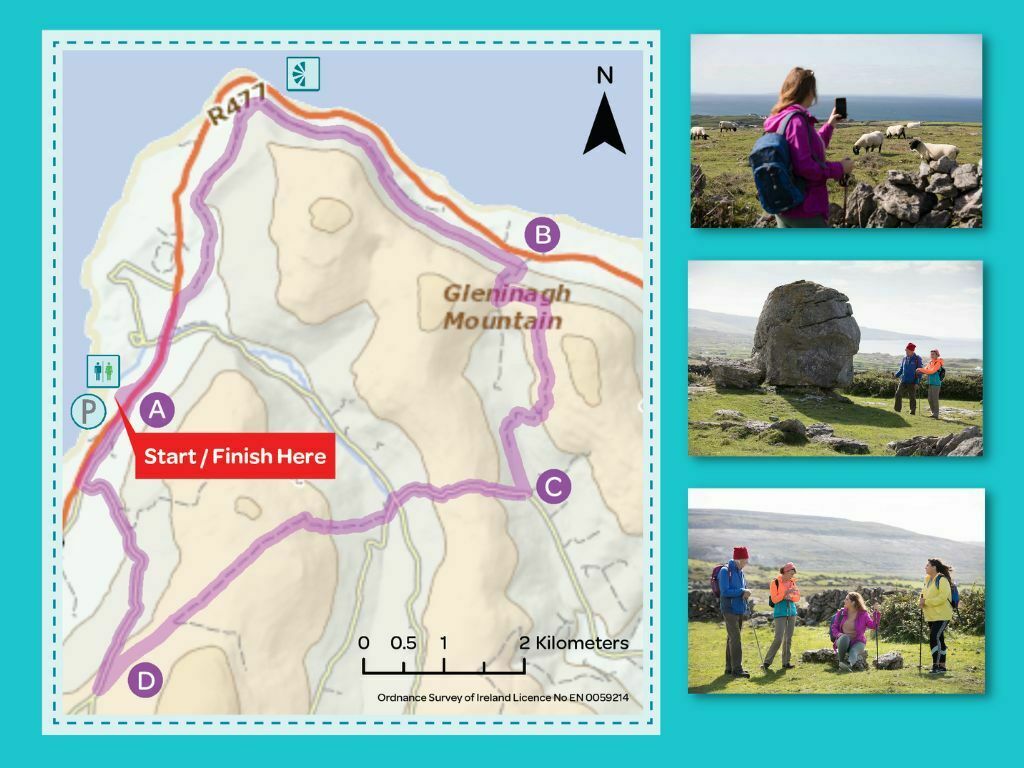
The loop commences in Fanore, gradually climbs north on the R477 and then up onto the old Green road around Blackhead. It crosses through the Gleninagh Pass, and into Feenagh Valley along the shoulder of Cappanwalla mountain. At a 3-way junction, the loop climbs again, passing by Caher an Ard Rois, where you travel a short distance on the surfaced road of the Caher Valley, passing through a crossroads. Another Green road takes you onto the shoulder of Slieve Elva, and into Ballelly, and back down into Fanore beach carpark.
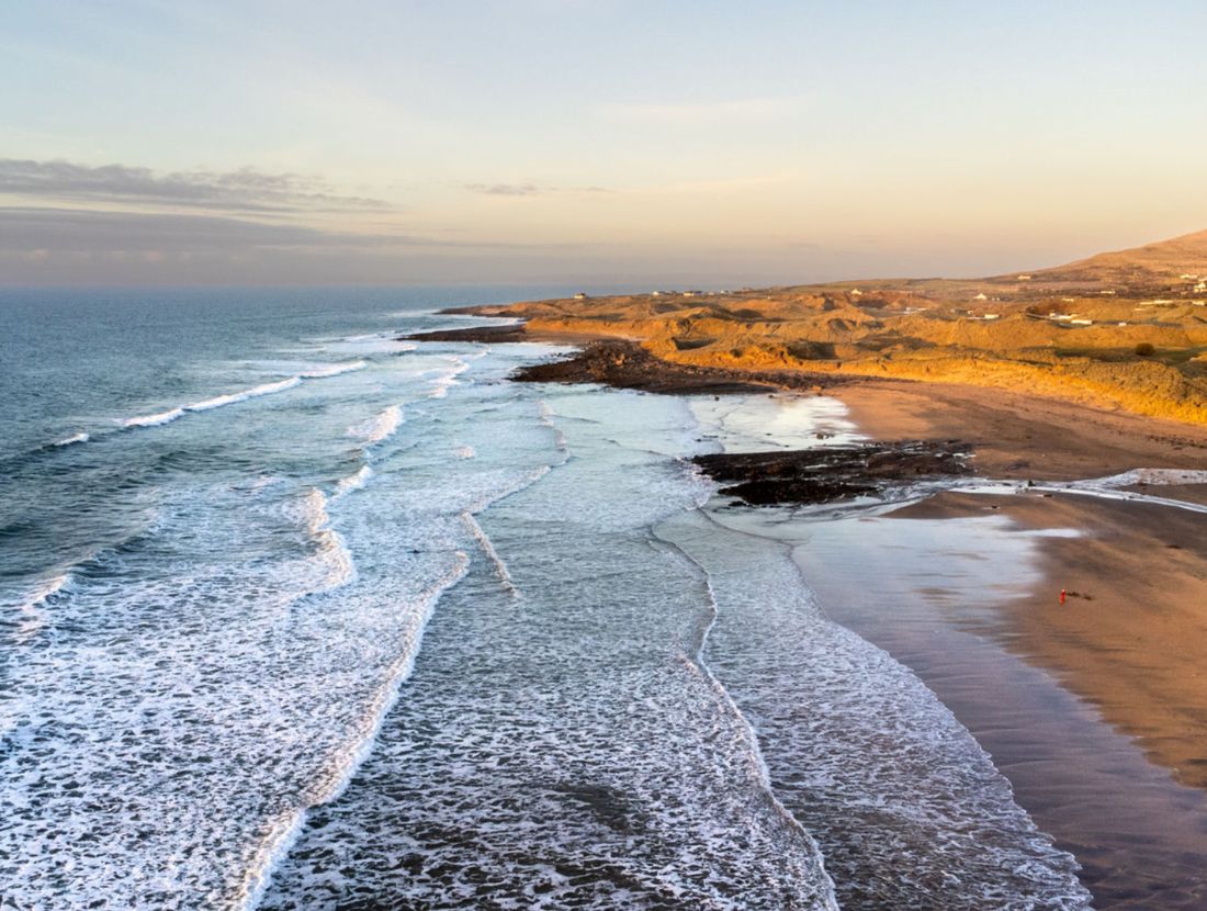
Explore the stark limestone beauty of Blackhead in striking 360°
Instructions: Click and drag to explore Blackhead from every angle. For the best effect, switch to full screen using the icon at the top right of the image.
Directions to trailhead
Start from the village of Fanore, which is located on the R477, halfway between Ballyvaughan village and Doolin village in County Clare. Fanore is a one-hour drive north of Ennis. The trailhead is located at Fanore Beach car park.
A-B: Starting from the map board at Fanore Beach, exit from the car park and turn left following the purple arrow. The other coloured arrows are for other walks that start and finish at the car park. Follow the road for over 1km (passing a crossroads after 500m) to reach a junction with a sandy roadway on your right – turn right here.
Follow this roadway uphill for 500m to reach a stone stile, where you cross into a field and join the Green Road, which takes you around Black Head. After 5km, the loop leaves the Green Road, and turns right and uphill to join a well-worn path along a stone wall. Follow this path/wall for over 2 km to reach a mountain path at a stone stile and metal gate (on your left). Continue straight on here.
B-C: For the next 1km, the mountain path ascends steeply to reach a stone stile at Gleninagh Pass. Cross the stile, turn left, and follow the stone wall on your left for 500m to another stone stile. Follow the waymarkers carefully now as the loop veers right away from the stone wall and swings right to reach a metal gateway and join a sand roadway along the shoulder of Cappanawalla (on your left). After 1.5 km, the sand roadway descends to join a surfaced roadway in Feenagh Valley. After 1km, you reach a 3-way junction where (as the signpost indicates) a number of walking trails meet. You follow the purple arrow and turn right here.
C-D: Now you follow the purple (and yellow) arrows up a steep stony roadway close to Caher an Ard Rois. After crossing the top, the descent takes you down to join the surfaced road of the Caher Valley. Turn right and, almost immediately, left. [Note: You have the option to take a shorter trek back to the trailhead at this point. Follow the surfaced roadway downhill for 4km and turn left when you reach the main R477.] Having turned left, follow the roadway for 50m to reach a junction with a green road where you veer right and climb onto the shoulder of Slieve Elva and down to reach a surfaced road at Ballelly. Turn right (and downhill) here.
D-A: Enjoy the descent toward the coastline for 3 km and reach a 3-way junction where you turn right onto a sandy roadway which joins the R477 at Fanore National School. Taking care of traffic, walk along the main R477 for 200m and re-enter Fanore beach car park.
Good to Know
Trailhead: Fanore Beach Carpark, North Clare
Services: Fanore, North Clare
Distance: 26km
Time: 5-6 hours
Difficulty: Hard
Terrain: Green roads, minor roadways, woodland tracks.
To suit: Higher than average level of fitness
Minimum Gear: Hiking boots, rain gear, snacks, fluids and mobile phone.
Download a 2-page Map Card
You can download a 2-page pdf of the Black Head Map Card Here
About Fanore