Explore Clare’s 17 Wild Atlantic Way discovery points
Here’s a challenge – take them all in!
Clare’s Wild Atlantic Way route takes you along our amazing coastline and 17 special Discovery Points, including 2 Signature Points – the Cliffs of Moher and Loop Head.Your Discovery Points map
Get to see as many as you can!
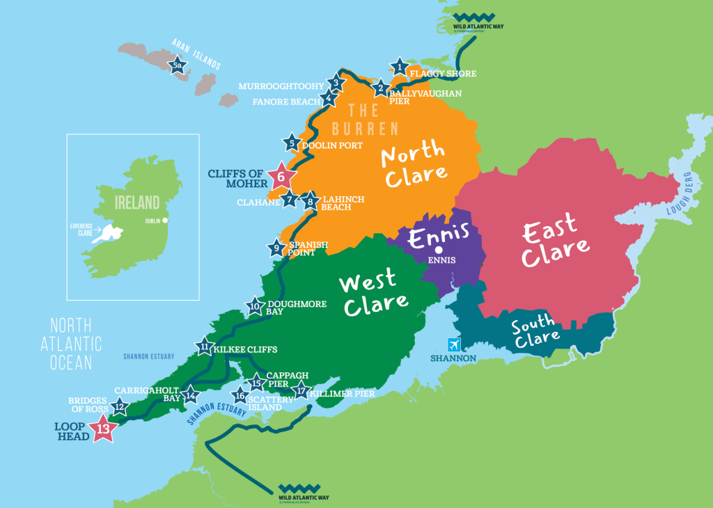
Our map highlights 17 Discovery Points along Clare’s amazing Wild Atlantic Way Route which takes in part of North Clare, West Clare, the Burren, Loop Head and the Shannon Estuary Way. The route starts at the Flaggy Shore and ends in Killimer (or vice versa). A challenge would be to take them all in during your time in Clare. You will love the experience, but don’t try to visit them in one day! Of course, you also have the option of picking those of most interest and heading straight to them. Enjoy the journey.
#1 The Burren’s Flaggy Shore
Experience its wonderful views
North Clare
The Flaggy Shore is one side of a small peninsula that stretches from the village of New Quay to Finvarra Point, and is one of the most northerly parts of County Clare. Famous for its limestone pavements and fossils that are embedded in the rock, including sculptured rocks along the shore called ‘Biokarst’. While the shore itself is beautiful, what makes the Flaggy Shore so distinctive is the wonderful views to the west and north to Galway Bay and the mountains beyond.
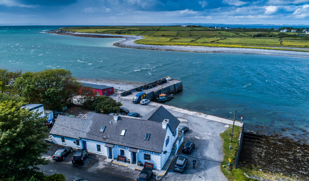
#2 Ballyvaughan Pier
A working quay in the Burren
Ballyvaughan, North Clare
Ballyvaughan Pier in Ballyvaughan village is located in the northwest corner of The Burren, one of the world’s unique landscapes. The village is nestled within the corner of the south shores of Galway Bay under Gleninagh Mountain. The harbour features a 50m long pier and a working quay used by boats plying the bay.
#3 Murrooghtoohy
Amazing views over Galway Bay
North Clare
Murrooghtoohy, in the most northerly tip of County Clare, has amazing views over Galway Bay and the surrounding coastline of the Aran Islands and Oranmore Bay, to the east of Galway city. Murrooghtoohy Discovery Point is characterised by the ‘lunar’ landscape of the Burren comprising smooth rocks and bordered sheer gullies known as ‘grykes’. Abundant flora grows within these grykes some distinctive to the Burren.
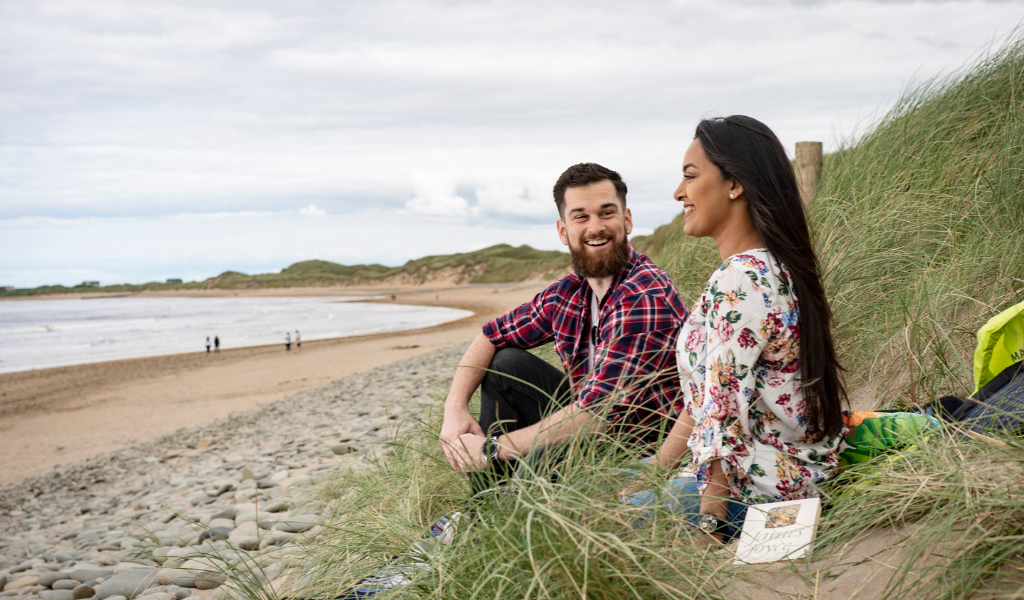
#4 Fanore Beach
A wonderful beach and dune sysytem
Fanore Beach, North Clare
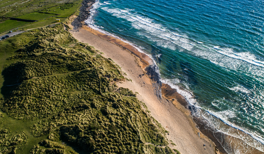
Fanore Beach is a beautiful, extensive sandy beach and a Discovery Point on Clare’s Wild Atlantic Way. It is located near the village of Fanore in the heart of the UNESCO Burren and Cliffs of Moher Geopark in North Clare. Fanore Beach is extremely popular with surfers, swimmers and walkers. The beach is backed by an extensive sand dune system which is protected by the European Habitats Directive.
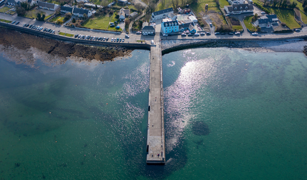
#5 Doolin Pier
Explore the pier and the village
Doolin, North Clare
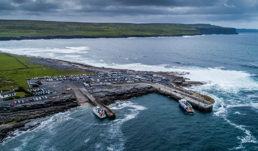
Doolin pier is situated close to the geological boundary between the limestones which make up most of the Burren and the sandstones and shales which dominate the south and west of County Clare. Ferries to the Aran Islands run daily during the high season from the Pier. From here, you can also take a cruise around the Cliffs of Moher. At the Pier, you can walk on the limestone pavement and explore rock pools. Nearby is the busy village of Doolin, famous for its traditional Irish music.
#5a The Aran Islands
The quickest route to them is via Doolin
Sail to it from Doolin, North Clare
The Aran Island is easily reached by passenger ferry from Doolin in North Clare. The Aran Islands consist of three islands – Inis Mór, Inis Meáin and Inis Oírr. These three islands have maintained the culture and heritage of traditional Irish life and fascinate the thousands of visitors who visit each year. Inis Oírr (Inisheer) is the smallest of the Aran Islands and the closest is to County Clare. It’s less than 3km (1.8 miles) in length and 2km (1.2 miles) wide. lnis Meáin (Inishmaan) is the middle island. It has an amazing landscape, including green fields bordered by dry-stone walls and the Atlantic Ocean crashing in the distance. Inis Mór (Inishmore) is the largest of the three islands. The island is circa 12km (7.4 miles) long and 3km (1.8 miles) wide. Ferry crossing times from Doolin vary from 15 to 35 minutes, depending on the island you are visiting.
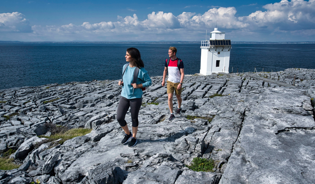
#6 Cliffs of Moher:
A signature point on the Wild Atlantic Way
Liscannor, North Clare
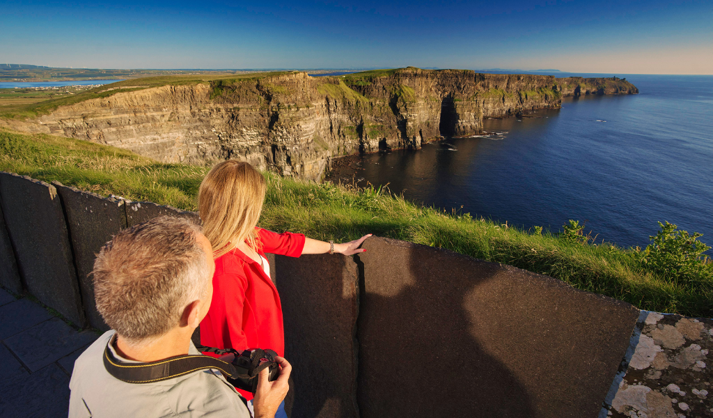
The world-famous Cliffs of Moher in County Clare is a Signature Discovery Point along Ireland’s Wild Atlantic Way. The Cliffs have featured in almost every pictorial guide to Ireland. However, no re-creation can substitute for a direct experience of their grandeur and sheer visual force. The Cliffs are Ireland’s top scenic visitor attraction. They are spectacular. They stretch for 8km as the crow flies and reach 214m at their highest point. O’Brien’s Tower (built in 1835), located on the highest cliff, is an exceptional viewing point.
#7 Clahane
Enjoy panoramic views of Liscannor Bay
Clahane, North Clare
Clahane is a palette of dramatic scenery that hosts the purest natural landscapes and has unhindered panoramic views of Liscannor Bay and beyond to Spanish Point and Mutton Island. Clahane offers unhindered panoramic views of Liscannor Bay and beyond to Spanish Point and Mutton Island. The village of Liscannor is located on the north side of the bay, and the village of Lahinch is at its eastern end.
#8 Lahinch Beach
a magnificent crescent-shaped beach at the head of Liscannor Bay
Lahinch, North Clare
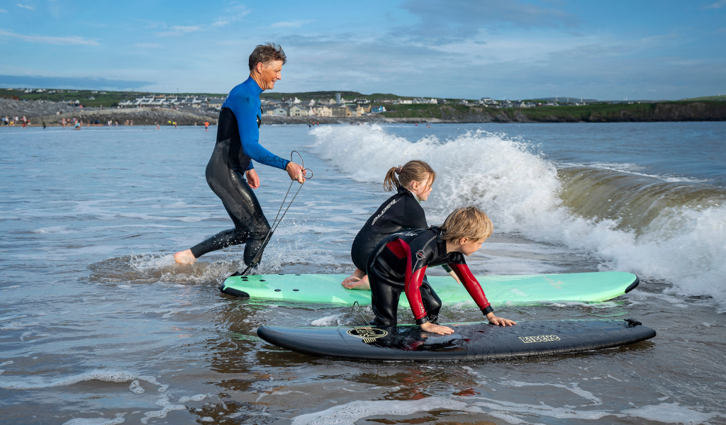
Lahinch Beach is a magnificent crescent-shaped beach at the head of Liscannor Bay on the Wild Atlantic Way. It is one of Ireland’s best-known and most loved beaches, with its golden sands stretching almost two kilometres around Liscannor Bay. Lahinch is synonymous with surfing, courtesy of the resort’s shape, which helps create the Atlantic breakers. As one of Western Europe’s leading surf centres, Lahinch attracts people worldwide to its many surf schools yearly. The beach is also a popular destination for lovers of other water sports, including swimming, kite surfing, sea kayaking, and diving. Lahinch is home to the world-rated Lahinch golf links.
#9 Spanish Point Beach
Nestled in the horseshoe-shaped Mal Bay
Spanish Point, West Clare
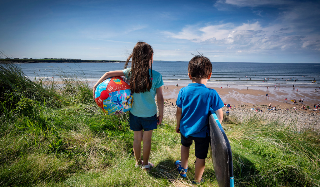
Spanish Point Beach is nestled in the horseshoe-shaped Mal Bay in West Clare. The lengthy sandy beach is a popular bathing and surfing area throughout the year. Spanish Point beach has plenty of amenities, including a surf school and surfboard rental, free parking, public toilets and shower facilities, an observation deck, picnic tables, and a Wildlife InformationPoint. Also, don’t miss out on Snámhaí Sásta, a local initiative which brings people together every morning for a swim at 9am after everyone gathers on the beach for a chat and a cup of tea.
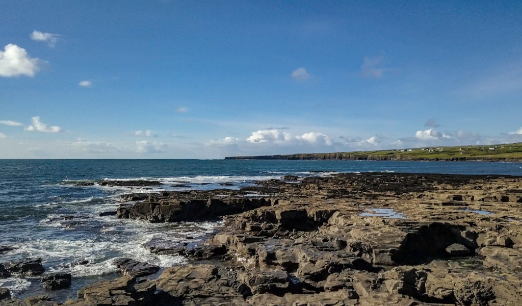
#10 Doughmore Bay:
Enjoy this long sandy beach.
Doughmore Bay is situated in the village of Doonbeg in West Clare. Stretching 4.5km, you can enjoy a walk on its long sandy beach. The area has become a popular spot for surfing, but with challenging waves.
#11 Kilkee Cliffs
Enjoy stunning views!
Kilkee, West Clare
You can experience some of the best scenery in Ireland at the magnificent Kilkee Cliffs in West Clare. For wonderful enjoyment, take on the Kilkee Cliff Walk along the rugged stretch of coastline. Start at the Diamond Rocks Cafe at Kilkee’s West End and follow the cliff path. See the shipwreck site of Intrinsic Bay, the Diamond Rocks that glitter in the sunshine, scenic Foonagh Bay, and the glorious views from Moveen Hill. You can choose a brisk 5km or more challenging 8km looped walk.
#12 Bridges of Ross
A spectacular natural sea arch
Bridges of Ross, West Clare
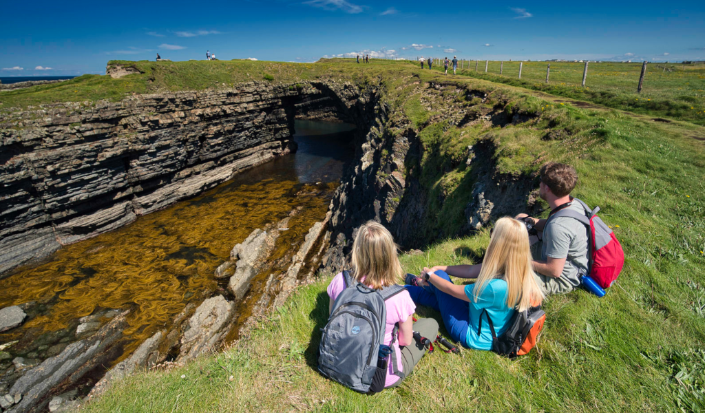
The Bridges of Ross on Loop Head Peninsula lies on the western side of a natural harbour (Ross Bay). They are located near the village of Kilbaha and offer amazing views of the Atlantic Ocean and the surrounding coastline. Historically, the Bridges of Ross referred to a trio of spectacular natural sea arches, two of which have since fallen into the sea. However, they are still referred to in the plural! You can view the remaining bridge by parking in the car park and walking a few hundred metres. It’s worth the walk!
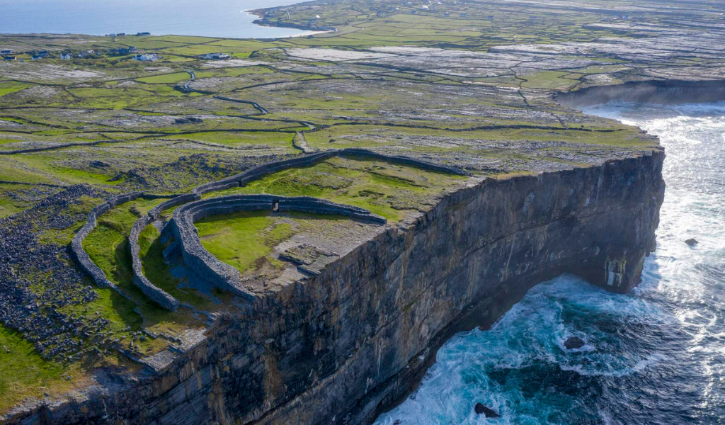
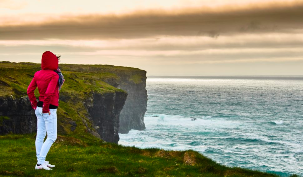
#13 Loop Head
An amazing Signature Discovery Point
Loop Head, West Clare
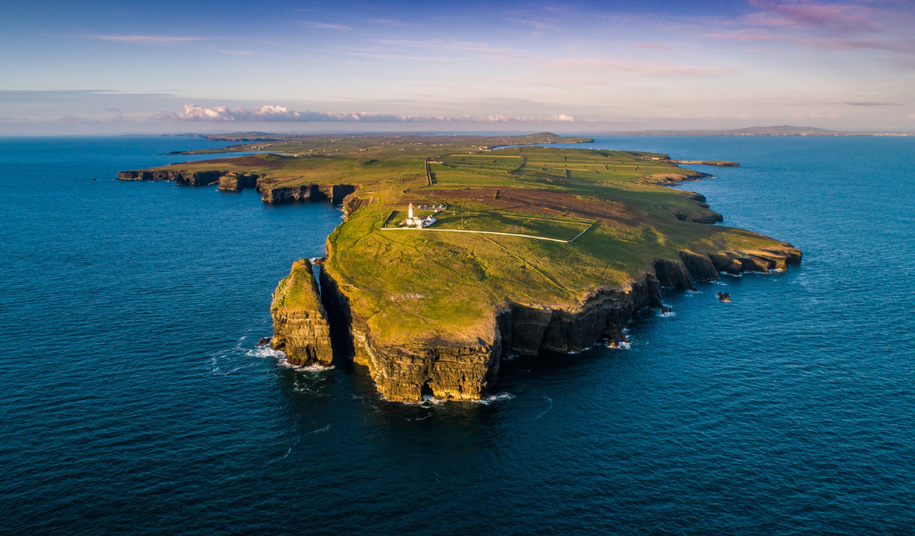
Loop Head in West Clare is a Signature Discovery Point in the most spectacular and naturally beautiful parts of Ireland. It is a narrow strip of land, bound on one side by the Shannon Estuary and the other by the awesome power of the Atlantic Ocean. Loop Head Lighthouse is perched at the tip of this Peninsula, the furthest point west on the County Clare coastline. The next large landmass to the west is North America! While Loop Head Lighthouse is a highlight, the entire peninsula is a designated European destination of excellence for aquatic tourism, is well worth exploring. Carrigaholt Bay:
#14 Kilrush Marina
Visit the Blue Flag Marina for great activies
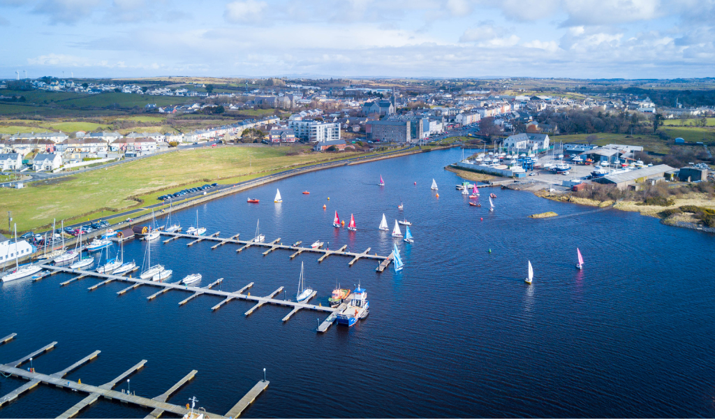
Kilrush Marina is a Blue Flag Marina – one of the world’s most recognised eco-labels. It offers a unique blend of facilities and activities that helps guarantee great days out. The tranquil waters of the sheltered harbour make it a secure haven for maritime and leisure enthusiasts. The Marina’s strategic location also makes it an ideal base from which to explore the 100 km long Shannon Estuary and gives access to the 200km long inland waterway system of the majestic river Shannon and its lakes and canals. The Marina provides a wonderful maritime environment for walks and leisure activities and is also the launch base for boat trips to historic Scattery Island or to meet up with the Shannon Estuary’s resident dolphin population (a real thrill). The West Coast Aqua Park is based at the Marina and features fun on-the-water obstacle courses for all the family to enjoy.
#15 Cappagh Pier
It dates back to 1764
Cappagh Pier, Kilrush, West Clare
Cappagh Pier was one of the most important factors in the development of Kilrush. The oldest section near the shore was built in 1764. The harbour was then frequented by vessels trading in grain and other commodities. Today, the Pier is still used very occasionally by ships, but you are more likely to find locals and visitors jumping off the pier enjoying the sea. Cappagh Pier is a designated Blue Flag Beach—ideal for a relaxing dip or a family outing.
#16 Scattery Island
The site of an early Christian settlement built in the early sixth century
Off Kilrush, West Clare
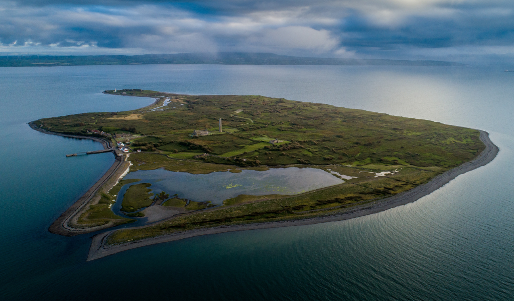
Scattery Island is a small island and lies just off the northern bank of the Shannon Estuary. It is the site of an early Christian settlement founded by St Senan, who was born in the area and built his monastery in the early sixth century. It includes a round tower which, at 36 metres, is one of the tallest in Ireland. It also features the ruins of a cathedral and several medieval churches. As well as these historical sites, the island has a lighthouse, an artillery battery, and the deserted village where the islanders lived until 1978. The island is home to various wild birds, animals and plant life. Scattery was invaded many times over the centuries. The Vikings, in particular, believed that the monastery held many riches and returned several times to ravage it. A short boat trip from the Kilrush Marina will take you to the island, where you can stroll around to explore its multi-layered 1,500-year history. You can also take a guided walking tour. The boat trip takes circa 20 minutes.
#17 Killimer Port
Home to Shannon Ferries, with car ferries crossing the Shannon Estuary daily
Killimer, West Clare
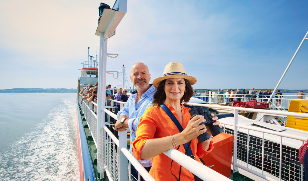
The Killimer Port in West Clare is home to Shannon Ferries, which operates a car ferry that crosses the Shannon Estuary, connecting Killimer in Clare to Tarbert in County Kerry. The Ferry saves you extra drive time when heading from Clare to Kerry or vice versa. From early morning as the mist descends on the Shannon Estuary to the setting of the sun in the late evening, Shannon Ferry will take you and your vehicle on this memorable 20-minute journey across the estuary. This is a lovely experience, and if you’re lucky, you might even catch a glimpse of the Shannon dolphins, which in the summer, can sometimes swim near the ferry, as if just to entertain you. This invigorating journey allows you to experience the rugged nature of land and sea as you breathe in the fresh salty sea air that encapsulates Ireland’s Wild Atlantic Way.